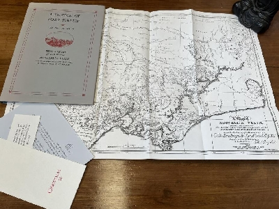
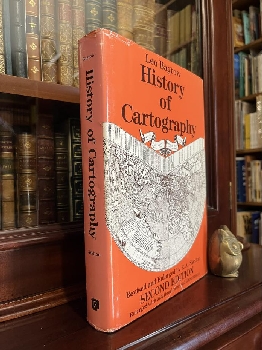
Australian Secondhand Books | Secondhand Books Australia | Antiquarian Books Australia | Military Books Online | Used Books Online | Australian Books Online | Time Booksellers | Second Hand Books Australia | Latest Acquisitions |
 

Latest Acquisitions

Cartography, History of Maps etc.

128485
ANDREWS, J. H.

Shapes of Ireland: Maps and Their Makers 1564-1839.
First Edition; Demy 8vo; pp. x, 346; text illustrated with over 90 b/w. maps, index, bound in original green cloth, title lettered in gilt on spine, dustjacket, very good copy.
Dublin; Geography Publications; 1997. Click here to Order
AUD$50

128444
ARDEN, GEORGE.

A Sketch Of Port Phillip. Being A Review of The Map Of Australia Felix Compiled, Engraved And Published By Thomas Ham Of Melbourne. To Which Is Added A Key To The Map Of Australia Felix And Its Squatting Districts In 1847. with A Modern Introduction By Thomas A Darragh, Esq.
Limited Edition Facsimile; Lge. 4to; pp. 47; 1, fold-out map, original cloth and papered boards, title lettered in black on spine, minor fading to top section of dustjacket, very good copy. With some associated publication notices from the publisher.
Thumb Creek, NSW; Garravembi Press, 1991.
Edition limited to 235 numbered copies. This copy being number 57. Click here to Order
AUD$135

128479
BAGROW, LEO; SKELTON, R. A.

History of Cartography.
Revised and Enlarged Edition (with additional maps and illustrations); Demy 4to; pp. [iv], 512; illustrated frontispiece, 36 pages of coloured maps, numerous b/w. text maps and illustrations, notes, list of cartographers, bibliography, index, bound in original blue cloth, title lettered in silver on spine, dustjacket chipped and damaged on edges, otherwise a very good copy.
Chicago, Illinois; Precedent Publishing Inc.; 1985. Click here to Order
AUD$50

128572
BINDING, PAUL.

Imagined Corners: Exploring the World's First Atlas.
First Edition; Cr. 4to; pp. [vi], 314; coloured endpaper maps, illustrated title page, text with numerous illustrations mostly in colour, index, bound in original blue cloth, title lettered in gilt on spine, dustjacket with minor creases on edges, very good copy.
London; Review; 2003. Click here to Order
AUD$40

128590
BLAKE, JOHN.

The Sea Chart: The Illustrated History of Nautical Maps and Navigational Charts.
First Edition; Demy 4to; pp. 160; illustrated frontispiece and title page, text illustrated with numerous coloured maps, bibliography, index, bound in original navy cloth, title lettered in gilt on spine, dustjacket, very good copy.
London; Conway Maritime Press; 2004. Click here to Order
AUD$45

128470
BOOTH, JOHN.

Looking at Old Maps.
First Edition; Cr. 4to; pp. xviii, 167; coloured frontispiece, text with 59 b/w. maps, glossary, index, bound in original grey cloth, title lettered in gilt on spine, dustjacket, good copy.
Westbury, Wiltshire; Cambridge House Books; 1979. Click here to Order
AUD$30

128463
BOWDEN, JIM; Compiler.

Getting There from here: A History of Commercial Mapping in Australia 1788--2000.
First Edition; Med. 4to; pp. 123, (40) coloured illustrations; text with numerous b/w. illustrations, 40 pages mostly in colour depicting early map and directory covers, cartographic pedigree, index, bound in original stiff printed wrappers, with cloth tape spine, very good copy.
Seaforth, NSW.; Rex Publications; 2000. Click here to Order
AUD$40

128571
BROTTON, JERRY.

A History of the World in Twelve Maps.
First Edition; Med. 8vo; pp. xviii, 514; 48 pages of coloured plates, several b/w. text maps and illustrations, notes, index, bound in original green cloth, title lettered in white on spine, dustjacket, fine copy.
London; Allen Lane/Penguin Books; 2012. Click here to Order
AUD$40

128619
BURDEN, PHILIP D.

The Mapping of North America, A List of printed maps 1511-1670.
First Limited Edition; Cr. Folio; xxxiv, 568; text with 11 coloured and 418 b/w. plates, index bibliography, bound in full maroon morocco, raised bands, title lettered in gilt on spine, gilt stamped decoration on front board, all edges gilt, housed in original cloth slipcase, fine copy.
Rickmansworth; Raleigh Publications; 1996.
Edition Limited to 25 numbered and signed copies. This copy being Number 7. Click here to Order
AUD$600

128407
CAMPBELL, TONY.

The Earliest Printed Maps 1472 - 1500.
First Edition; Cr. 4to; pp. xii, 244; text illustrated with 69 maps, tables and indexes, chronological index, index by place of publication, bibliography, index of personal names, geographical and subject index, bound in original brown cloth, title lettered in gilt on spine, dustjacket, very good copy.
London; The British Library; 1987. Click here to Order
AUD$135

128604
CAVALLO, GUGLIELMO.

Cristoforo Colombo e l'apertura degli spazi (Christopher Columbus and the opening of Spaces), (Two Volume Set). Italian Language.
First Edition; Demy 4to; Vol. I. pp. xx, 529; Vol. II. pp. [v], 530-1113; texts illustrated with numerous maps mostly in colour some folding, bibliografia, indice dei nomi di persona, each volume bound in original stiff illustrated wrappers, fine copies.
Rome; Istituto Poligrafico E Zecca Dello Statp; 1992. Click here to Order
AUD$60

128447
CHAPPEL, K. L.

Surveying for Land Settlement in Victoria 1836 - 1960: Survey of the Vic-NSW Boundary, Survey of the Vic-SA Boundary.
First Edition; Med. 4to; pp. vii, 166; endpaper maps, illustrated with 13 folding maps and plans, several b/w. text illustrations, index, bound in original stiff illustrated wrappers, fine copy.
Melbourne, Vic.; Office of Surveyor General; 1996. Click here to Order
AUD$150

128498
CLANCY, ROBERT.

The Mapping Of Terra Australis.
First Edition; Demy 4to; pp. (x), 192; frontispiece; profusely illustrated, with numerous maps, bibliography, index; dustjacket, previous owner's inscription on front endpaper otherwise a fine copy.
Macquarie Park, NSW; Universal Press Pty. Ltd.; 1995.
The Mapping of Terra Australis takes the reader on a voyage of discovery. It focuses on the printed maps that record the evolution of our knowledge of Terra Australis with a particular emphasis on first the discovery and later the exploration of Australia. Click here to Order
AUD$55

128495
CLANCY, ROBERT; HARCOMBE, PAUL.

Maps that Shaped Australia.
First Edition; Square Med. Folio; pp. xiv, 166; endpaper maps, illustrated title page, illustrated with 89 coloured maps, references, bound in original slick illustrated boards, fine copy.
Sydney; Land & Property Information; n.d. (2011). Click here to Order
AUD$125

128501
CLANCY, ROBERT; RICHARDSON, ALAN.

So Came They South. Library Reference Series.
First Edition; Med. 4to; pp. 176; endpaper maps, b/w frontispiece, b/w, colour illustrations and maps throughout, index, original cloth, dustjacket spine slightly faded, very good copy.
Silverwater, NSW; Shakespeare Head Press; 1988. Click here to Order
AUD$35

128512
CLOSE, CHARLES.

The Early Years of the Ordnance Survey. Reprint with a new introduction by J. B. Harley and with and Index added.
Reprint; Demy 8vo; pp. xxxv, 164; text with numerous b/w. illustrations, index, bound in original stiff illustrated wrappers, very good copy.
Newton Abbot; David & Charles Publishers Ltd.; 1969. Click here to Order
AUD$30

128423
COLLINGRIDGE, GEORGE.

The First Discovery Of Australia And New Guinea.
Reprint; Cr. 8vo; pp. xxii, 130; 14 maps, 34 colour and b/w illustrations; original stiff illustrated wrapper, a very good copy.
Sydney; Pan Books; 1982. Click here to Order
AUD$30

128415
COULTHARD-CLARK, C.D.

Australia's Military Map-Makers. The Royal Australian Survey Corps 1915-96.
First Edition; Demy 8vo; pp. x, 246; b/w plates, 10 colour maps, abbreviations, glossary, appendices, notes, bibliography, index, bound in original green cloth, title lettered in white on spine, dustjacket, previous owner's name on front endpaper, otherwise a fine copy.
Melbourne; Oxford University Press; 2000. Click here to Order
AUD$100

128468
COVENS & MORTIER.

Stock Catalogues of Maps and Atlases by Covens & Mortier: The 'Catalogus Van Verscheyde Koopere Plaaten' of the heirs of Pieter Mortier's Widow (1721) and the 'Catalogue Nouveau Des Cartes Geographiques' of Coven & Mortier (1763).
Facsimile Edition; Demy 8vo; pp. 141; bound in original stiff printed wrappers, fine copy.
Utrecht, Netherlands; H & S Publishers; 1992.
Covens & Mortier were one of the biggest producers of maps and atlases in Amsterdam in the eighteenth century. This book features the facsimile edition of the catalogue of copper plates and a stock catalogue originally issued in 1721 and 1763. Also included are an introduction on the catalogues and an introductory history on Covens & Mortier by Peter van der Krogt. Click here to Order
AUD$100

128577
CRANE, NICHOLAS.

Mercator: The Man Who Mapped The Planet.
First Edition; Med. 8vo; pp. xiv, 348; endpaper maps, 16 pages of coloured plates, numerous b/w. text illustrations, notes, chronology, select bibliography, index, bound in original blue cloth, title lettered in gilt on spine, dustjacket, fine copy.
London; Weidenfeld & Nicolson; 2002. Click here to Order
AUD$35

128471
CRONE, G. R.

Maps and their Makers: An Introduction to The History of Cartography.
Fourth Revised Edition; Demy 8vo; pp. 184; coloured frontispiece map, text illustrated with several b/w. maps, index, bound in original brown cloth, title lettered in gilt on spine, dustjacket with some minor chips on edges, very good copy.
London; Hutchinson University Library; 1968. Click here to Order
AUD$35

128518
DANZER, GERALD A.

Images of the Earth on Three Early Italian Woodcuts: Candidates for the Earliest printed Maps in the West. (The Hermon Dunlap Smith Center for the History of Cartography, Occasional Publication No. 5).
First Edition; Demy 4to; pp. v, 35; text with 11 pages of b/w. illustrations, references, bound in original stiff printed stapled wrappers, very good copy.
Chicago; The Newberry Library; 1991. Click here to Order
AUD$45

128392
DAVID, ANDREW C. F; Compiler.

A Catalogue of Charts, Plans, & Views, printed at The Admiralty Office, for the use of His Majesty's Navy in 1814. (Based mainly on a manuscript list presented to The British Museum 12th November 1814.).
First Edition; Demy 8vo; pp. vii, 33; bound in green cloth, title lettered in gilt on spine, fine copy.
Andrew David Taunton; 1991.
The first Admiralty Chart Catalogue was not issued until 1821, though copies of this particular catalogue do not appear to have survived. The 1825 Catalogue which is held in the Hydrographic Office, Ministry of Defence, Taunton, is the earliest known catalogue to have survived. It has now been possible to construct an earlier catalogue based on a manuscript, listing 103 items presented to the British Museum on the 12th November 1814 by Captain Thomas Hurd, Hydrographer to the Admiralty. Click here to Order
AUD$50

128461
DAWSON, COMMANDER L. S.

Memoirs of Hydrography including Brief Biographies of the Principal Officers who have Served in H. M. Naval Surveying Service Between The Years 1750 and 1885. (In Two Parts Bound as One).
Med. 8vo; Part I, pp. [xvi], 143 (2); Part II, pp. [iv], 209, (4); text illustrated with 2 b/w. portraits, 1 full page scale plan, bound in original quarter beige cloth, with blue cloth boards, title lettered in gilt on spine, previous owner's bookplate on front endpaper, good copy.
London; Cornmarket Press Limited; 1969. Click here to Order
AUD$90

128482
DEPARTMENT OF NATIONAL DEVELOPMENT.

Index To Australian Resource Maps - Volume 1 1940-59; Volume 2 Supplement for 1960-64.
Med. 8vo; Vol. 1. pp. 241; Vol. 2. pp. [viii, 250; illustrated with 10 folding maps some in colour, bound in original stiff printed wrappers with cloth spines, very good copies.
Canberra; Department of National Development; 1961 & 1966. Click here to Order
AUD$60

128434
DILKE, O. A. W.

Greek and Roman Maps: Aspects of Greek and Roman Life.
First Edition; Demy 8vo; pp. 224; 16 pages of b/w. photographic plates, numerous text line illustrations and maps, notes, select bibliography, sources, index, bound in original grey cloth, title lettered in gilt on spine, dustjacket, very good copy.
Ithaca, NY; Cornell University Press; 1985. Click here to Order
AUD$35

128700
DORLING KINDERSLEY PUBLISHING STAFF.

Complete Atlas of the World.
Second Edition reprinted with revisions; Impl. 4to; pp. 432; illustrated endpapers, illustrated frontispiece and title page, text illustrated with numerous coloured maps, index, gazetteer, bound in original slick illustrated boards, vey good copy.
London; Dorling Kindersley Publishing; 2012. Click here to Order
AUD$30

128386
ECCLESTON, GREGORY C.

Granville Stapylton: Australia Felix 1836: Second in Command to Major Mitchell.
First Edition; Oblong Cr. Folio.; pp. xx, 250; text with numerous illustrations, drawings and maps many in colour, bibliography, glossary of Foreign Words and Phrases in the Journal, index, bound in original green cloth, title lettered in gilt on spine, dustjacket, original silk page marker, dustjacket, inscribed and signed by the author on title page, fine copy. Together with original prospectus and order form.
Melbourne; Evandale Publishing; 2018.
Splendid and impressive volume, a major study based on the journals of the pioneer land surveyor Granville Stapylton second-in-command to major Mitchell. Of particular importance are the wealth of images and maps throughout. Click here to Order
AUD$140

128478
EHRENBERG, RALPH E.

Mapping the World: An Illustrated History of Cartography.
First Edition; Demy 4to; pp. 256; coloured map frontispiece, text illustrated with numerous maps mostly in colour, bibliography, index, bound in original grey cloth, title lettered in silver on spine and upper board, dustjacket chipped on edges, good copy.
Washington; National Geographic; 2006. Click here to Order
AUD$30

128516
EISLER, WILLIAM: SMITH, BERNARD.

Terra Australis The Furthest Shore.
Demy 4to; pp. 240; portrait frontispiece, numerous text illustrations in colour and b/w, text maps, bibliography, notes on the contributors, photographic credits, lenders to the exhibition, selected index, bound in original stiff illustrated wrappers, good copy.
Published by The Australian Bicentennial Authority, to accompany the exhibition at the Art Gallery of New South Wales 27 July - 9 October 1988.
The exhibition which this book was produced for offered a fascinating panorama of three centuries of daring voyaging, acute observation, and vivid reporting, in words and images, of newly discovered seas, lands, and peoples. Click here to Order
AUD$35

128432
ERICSSON, CHRISTOFFER H; MIEKKAVAARA, LEENA; NURMINEN, JUHA; RAURALA, NILS-ERIK.

The Routes Of The Sea: Sea Charts from the 16th Century to Present Times.
First Edition; Oblong Cr. 4to; pp. 160; 6 pages of coloured maps, numerous b/w. maps and illustrations in text, catalogue of sea charts and maps, bound in original blue cloth, title lettered in gilt on spine, dustjacket very good copy.
Helsinki; John Nurminen; 1988. Click here to Order
AUD$125

128433
FELL, R. T.

Early Maps of South-East Asia.
Second Edition; Cr. 8vo; pp. xii, 122; 16 pages of coloured plates, text with numerous b/w. maps and illustrations, select bibliography, index, bound in original slick illustrated boards, fine copy.
Singapore; Oxford University Press; 1991. Click here to Order
AUD$50

128457
FISHER, SUSANNA.

The Makers of the Blueback Charts.
First Edition; Cr. 4to; pp. x, 158; family tree frontispiece, text with numerous illustrations a few in colour, sources & notes, glossary, list of staff, index, bound in original blue cloth, title lettered in gilt on spine, dustjacket, fine copy.
Cambridgeshire, England; Imary Laurie Norie & Wilson; 2001. Click here to Order
AUD$55

128419
FITZGERALD, LAWRENCE.

Lebanon to Labuan. A Story of Mapping. By The Australian Survey Corps World War II (1939 to 1945).
First Edition; Demy 4to; pp. xii, 124; endpaper maps, numerous illustrations throughout (mainly photographs, 5 maps), 3 appendices, index, bound in original decorated boards, title lettered in purple on spine, dustjacket with a couple of minor chips on edges otherwise a very good copy in original mailing box.
Melbourne; J.G.Holmes Pty. Ltd.; 1980.
A history of the Australian Survey Corps (1939-1945). Click here to Order
AUD$70

128428
FRENCH, JOSEPHINE; SCOTT, VALERIE; Editors.

Tooley's Dictionary of Mapmakers (Revised Editions) Complete in four Parts. Part One A - D: Part Two E - J: Part Three K - P: Part Four Q - Z.
Revised Editions; Cr. 4to; Part One. pp. xiv, 408; Part Two. pp. vi, 462; Part Three. pp. vi, 472; Part Four. pp. vi, 436; marbled endpapers, texts with numerous b/w. illustrations, all uniformly bound in original maroon cloth, titles lettered in gilt on spines and upper boards, dustjackets, with a few very minor creases on edges, otherwise a fine set.
Map Collector Publications/Early World press; 1999, 2001, 2003 & 2004. Click here to Order
AUD$750

128456
GEORGE, WILMA.

Animals and Maps.
First US Edition; Med. 8vo; pp. 235; illustrated endpapers, text with numerous b/w. illustrations and maps, references, index, bound in original maroon cloth, title lettered in gilt on spine, gilt stamped decoration on upper board, good copy.
Berkeley; University of California Press; 1969. Click here to Order
AUD$30

128496
GOFFART, WALTER.

Historical Atlases: The First Three Hundred Years 1570-1870.
First Edition; Med. 8vo; pp. xxiv, 603; text illustrated with 32 b/w. maps, index of maps and atlases, index of secondary literature cited in the notes, subject index, bound in original grey cloth, title lettered in silver on spine, dustjacket, very good copy.
Chicago; The University of Chicago Press; 2003. Click here to Order
AUD$115

128592
GOHM, DOUGLAS.

Antique Maps of Europe, the Americas, West Indies, Australasia, Africa, the Orient.
First Edition; Demy 4to; pp. 128; map endpapers, colour frontispiece, profusely illustrated with colour and b/w maps, index, bound in original brown cloth, title lettered in gilt on spine and gilt decoration on upper board, dustjacket a little creased on edges, good copy.
London; Octopus Books; 1972. Click here to Order
AUD$40

128451
GREAT BARRIER REEF.

Cook, Cays and Corals: A Bibliography of Publications about the Great Barrier Reef Marine Park Cairns Section.
First Edition; Med. 8vo; pp. [iv], 292; author index, subject index, bound in original stiff illustrated wrappers, very good copy.
Townsville, Qld.; Great Barrier Reef Marine Park Authority; November 1982. Click here to Order
AUD$60

128455
GREAT BARRIER REEF.

Maps of The Great Barrier Reef: An Indexed List of Maps and Charts of the Great Barrier Reef Region.
First Edition; Med. 8vo; pp. [iv], 186; locality index, bound in original stiff illustrated wrappers, very good copy.
Townsville, Qld.; Great Barrier Reef Marine Park Authority; n.d. (1984). Click here to Order
AUD$60

128446
HAM, THOMAS.

A Map Of Australia Felix.
Limited Edition; Cr. 8vo; pp. [vi], 39; tipped-in frontispiece facsimile prospectus, 1 large coloured folding cloth backed map; full leather binding in Bourbon calfskin, hand gilt work on spine and inner boards, cardboard slip-case, fine copy.
Carlton, Vic.; Queensberry Hill Press; n.d. (1985).
Edition limited to 155 copies. This copy being No. 25. Click here to Order
AUD$195

128507
HANCOX, DAVID; PRESCOTT, VICTOR.

Secret Hydrographic Surveys In The Spratly Islands.
First Edition; Demy 8vo; pp. x, 219; illustrated with 12 pages of maps, references, bound in original blue cloth, title lettered in gilt on spine and upper board, dustjacket, very good copy.
Kuala Lumpur; Maritime Institute of Malaysia; 1997. Click here to Order
AUD$75

128421
HARDSTAFF, R. J.

Leadline to Laser. The Hydrographic Service, Royal Australian Navy 1920-1995.
First Limited Edition; Lge. 4to; pp. xvi, 274; numerous b/w illustrations, appendices, conversions, abbreviations and acronyms, indices, bound in original stiff illustrated wrapper, previous owner's name on front endpaper, otherwise a fine copy. Together with the 12 page Errata slip.
Northwood, NSW; R. J. Hardstaff; 1995
Limited edition of 900 copies, this copy being No. 233, signed by the author. Click here to Order
AUD$95

128573
HARLEY, J. B.

Christopher Greenwood County Map-Maker and His Worcestershire map of 1822.
First Edition; Demy 4to; pp. viii, 72; 3 b/w. photographic plates, 10 text maps, 4 large folding maps in pocket at rear of book being each a quarter of the Worcester map, list of maps by Greenwood, general index, bound in original blue cloth, title lettered in gilt on spine, corners of cloth a little bumped, small institution stamp on bottom corner of title page, otherwise a good copy.
Worcester; Worcestershire Historical Society; 1962. Click here to Order
AUD$90

128379
HARLEY, J. B; WOODWARD, DAVID.

The History of Cartography: Volume 1. Cartography in Prehistoric, Ancient, and Medieval Europe and the Mediterranean.
Demy 4to; pp. xxii, 599; illustrated with 40 coloured plates, numerous b/w. illustrations, numerous tables, bibliographical index, general index, bound in original grey cloth, title lettered in gilt on spine, dustjacket, previous owner's (Dorothy F. Prescott) bookplate on front endpaper, very good copy.
Chicago; University of Chicago Press; 1987. Click here to Order
AUD$250

128381
HARLEY, J. B; WOODWARD, DAVID.

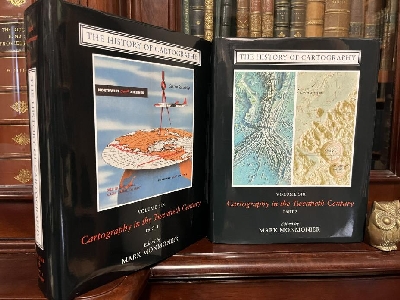
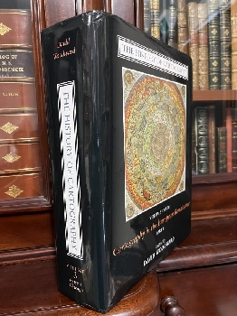
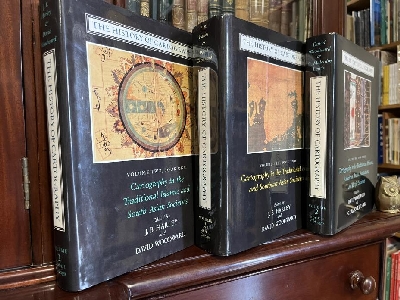
The History of Cartography: Volume 2. - Book 1, Cartography in the Traditional Islamic and South Asian Societies. - Book 2, Cartography in the Traditional East and Southeast Asian Societies. - Book 3, Cartography in the Traditional African, American, Arctic, Australian, and Pacific Societies.
First Editions; First Printings; Demy 4to; Book 1. pp. xxiv, 579; Book 2. pp. xxviii, 970; Book 3. pp. xxii, 639; each illustrated with coloured plates, numerous b/w. illustrations, numerous tables, bibliographical indexes, general indexes, each uniformly bound in original publishers grey cloth, title lettered in gilt on spine, dustjacket, previous owners (Dorothy F. Prescott) bookplate on front endpaper, very good copies.
Chicago; University of Chicago Press; 1992, 1994, and 1998. Click here to Order
AUD$1000

128449
HARRIS, C. H.

Survey Department of South Australia. Field Service. Handbook for Government Surveyors.
Fourth Edition; Cr, 4to; pp. 152; 17 folding plates (maps and charts and tables) at rear, numerous text tables, bound in original pebbled green cloth, title lettered in gilt on upper board, two small name stamps on first couple of pages, one small school stamp on title page, very good copy.
South Australia; R. E. E. Rogers, Government Printer; 1914. Click here to Order
AUD$125

128515
HARVEY, P. D. A.

Mappa Mundi: The Hereford World Map.
First Edition; Demy 8vo; pp. [vi], 58; illustrated frontispiece and title page, text with numerous map illustrations mostly in colour, select bibliography, index, bound in original stiff illustrated wrappers, very good copy.
London; The British Library; 1996. Click here to Order
AUD$35

128413
HARVEY, P. D. A.

Medieval Maps.
First US Edition; Demy 4to; pp. 96; illustrated frontispiece and title page, text illustrated with numerous maps mostly in colour, index, bound in original green cloth, title lettered in gilt on spine, dustjacket, previous owner's bookplate on front endpaper, very good copy.
Toronto; University of Toronto Press; 1991. Click here to Order
AUD$50

128416
HERVE, ROGER. ( DUNMORE, JOHN; Translated by ).

Chance Discovery. Of Australia and New Zealand by Portuguese and Spanish Navigators between 1521 and 1528.
First Edition; Demy 8vo; pp. 70; 2 b/w illustrations, 1 map, original illustrated wrapper, previous owner's name on front endpaper, otherwise a fine copy.
Palmerston North NZ.; The Dunmore Press; 1983.
Brings together many important works including John Rotz's Boke of Idrography, 1542: Portugese-Norman Portulan maps, Dieppe Planisperes analysis, first European voyages of exploration to Australasia, evidence of the Voyages Avantureux, presumed course of the Caravel San Lesmes in 1526-1527. Click here to Order
AUD$65

128511
HODGKISS, ALAN.

Understanding Maps: A Systematic History of their Use and Development.
First Edition; Cr. 4to; pp. 209; text with numerous b/w. illustrations and maps, select bibliography, index, bound in original brown cloth, title lettered in gilt on spine, dustjacket a little chipped and worn on edges, good copy.
Kent England; Wm Dawson & Son Ltd.; 1981. Click here to Order
AUD$35

128519
HODSON, DONALD; Compiler.

County Atlases of The British Isles Published after 1703. Volume III. Atlases published 1764 to 1789 and their subsequent editions.
First Edition; Demy 8vo; pp. xvi, 208; text illustrated with 7 full page b/w. plates, chronological list of atlases, index, bound in original green cloth, title lettered in gilt on spine, very good copy.
London; The British Library; 1997. Click here to Order
AUD$35

128486
HOLZHEIMER, ARTHUR; BUISSERET, DAVID.

The "Ramusio" Map of 1534. (The Hermon Dunlap Smith Center for the History of Cartography, Occasional Publication No. 6.).
Facsimile Edition; Demy 4to; pp. v, 33; 9 full page b/w. plates, 1 tipped-in coloured facsimile of the "Ramusio" on back endpaper, bibliography, bound in original stiff printed wrappers, very good copy.
Chicago; The Newberry Library; 1992. Click here to Order
AUD$45

128411
HOWSE, DEREK; SANDERSON, MICHAEL.

The Sea Chart: An Historical Survey based on the Collections in the National Maritime Museum.
First Australian Edition; Demy 4to; pp. 144; 7 full page coloured maps, text with numerous b/w. maps and charts, index, bound in original red cloth, title lettered in silver on spine, dustjacket, some minor browning to first and last few pages, good copy.
Melbourne; Lansdowne Press Pty Ltd.; 1973. Click here to Order
AUD$30

128499
HUAN, MA.

Iing-Yai Sheng-Lan: The Overall survey of the Ocean's Shores [1433]. Translated from the Chinese text edited by Feng Ch'eng-Chun with introduction, notes and appendices by J. V. G. Mills formerly Puisne Judge Straits Settlements.
First Edition; Med. 8vo; pp. xx, 393; portrait frontispiece, illustrated with 11 maps including one large folding map inside the back cover, bibliography, index, bound in original blue cloth, title lettered in gilt on spine, gilt stamped decoration on upper board, dustjacket chipped on edges, previous owners bookplate on front endpaper, previous owner's name on front endpaper, good copy.
Cambridge: Published for the Hakluyt Society at The University Press; 1970. Click here to Order
AUD$225

128594
HUMPHREYS, A. L.

Antique Maps and Charts.
New Edition; Demy 4to; pp. 191; text illustrated with numerous maps some in colour, list of useful books, bound in original navy cloth, title lettered in gilt on spine, dustjacket, very good copy.
London; Bracken Books; 1989.
Previously published as "Old Decorative Maps and Charts" in 1926. Click here to Order
AUD$30

128387
JOLLY, DAVID C.

Maps In British Periodicals Part I Major Monthlies before 1800. Part II. Annuals Scientific Periodicals & Miscellaneous Magazines Mostly before 1800.
First Editions; Demy 8vo; Part I. pp. 256; part II. pp. 320; frontispiece maps, bibliographical information, yearly totals, table of engravers, references cited, index by reference, index by engraver, index by name, index by geographical region, index by title, uniformly bound in publishers red cloth, title lettered in gilt on spine, previous owner's name on front endpapers otherwise fine copies.
Brookline, Massachusetts; David C. Jolly; 1990 & 1991. Click here to Order
AUD$225

128442
JONES, ALAN.

Backsight. A History of Surveying in Colonial Tasmania.
First Edition; Cr. 4to; pp. ix, 235; portrait frontispiece, numerous b/w maps and illustrations throughout, appendices, sources, further reading, index of names and place names, bound in original blue cloth, title lettered in gilt on spine, dustjacket, fine copy.
Hobart; The Institution of Surveyors, Australia Inc; 1989. Click here to Order
AUD$95

128453
JONES, PHYLLIS MANDER.

The Tasman Map of 1644 Historical Note and Description of the Manuscript Map in the Mitchell Library, Sydney.
Limited Edition; Demy 8vo; pp. 31; tipped-in full page coloured map, double page map with two other b/w. maps on the verso, selected bibliography, bound in original stiff stapled illustrated wrapper, good copy
Sydney; The Trustees of the Public Library of New South Wales; 1948. Click here to Order
AUD$40

128384
KARROW, ROBERT W.

Mapmakers of the Sixteenth Century and Their Maps.
First Edition; Cr. 4to; pp. xxx, 846; illustrated with 44 pages of plates, bibliography, index to place of publication, index to date of publication, general index, bound in original green cloth, title lettered in white on spine, dustjacket, inscribed and signed by the author on front endpaper, previous owner's bookplate on front endpaper, very good copy.
Chicago; speculum Orbis Press; 1993. Click here to Order
AUD$325

128484
KEJLBO, IB RONNE.

Manuscript Maps in the Frederik den Femtes Atlas.
First Edition; Med. 8vo; pp. 38; bound in original stiff printed wrappers, very good copy.
Copenhagen; The Royal Library; 1969. Click here to Order
AUD$30

128600
KINAHAN, JILL.

By Command of their Lordships.
First Edition; Demy 8vo; pp. [viii], 216; text with numerous b/w. illustrations and maps, references, index of African place names, bound in original stiff illustrated wrappers, good copy.
Windhoek; Namibia Archaeological Trust; 1992. Click here to Order
AUD$30

128458
KING, GEOFFREY.

Miniature Antique Maps: An Illustrated Guide for the Collector.
First Edition; Cr. 4to; pp. [ii], 200; illustrated frontispiece, text illustrated with numerous b/w. maps, index of maps, bound in original red cloth, title lettered in gilt on spine, dustjacket, fine copy.
Tring, Hertfordshire; Map Collector Publications Limited; 1996. Click here to Order
AUD$50

128427
KITSON, BILL; MCKAY, JUDITH.

Surveying Queensland 1839-1945: A Pictorial History.
First Edition; Demy 4to; pp. [x], 210; illustrated endpapers, text with numerous photographic illustrations some in colour, several maps, endnotes, select bibliography, index, bound in original stiff illustrated wrappers, inscribed and signed by Bill Kitson on the half title page, very good copy.
Brisbane, Qld.; Queensland Department of Natural Resources and Water and Queensland Museum; 2006. Click here to Order
AUD$95

128514
KLEIN, CHRISTOPHER M.

Maps in Eighteenth-Century British Magazines: A Checklist. ( The Hermon Dunlap Smith Center for the History of Cartography, Occasional Publication No. 3. ).
First Edition; Demy 4to; pp. xvii, 72; several charts of number of maps published, subject, author, and title index, bound in original stiff printed wrappers, very good copy.
Chicago; The Newberry Library; 1989. Click here to Order
AUD$40

128517
LIEBENBERG, ELRI; Editor.

Proceedings of the Symposium on The History Of Cartography Of Africa: Held at the National Library of South Africa, Cape Town, South Africa, August 4 - 5, 2003.
First Edition; Demy 4to; pp. 155; text illustrated with numerous b/w. illustrations and maps, references, bound in original stiff printed wrappers, good copy.
Pretotia; International Cartographic Association; 2003. Click here to Order
AUD$30

128475
LINES, JOHN D.

Australia on Papers: The Story of Australian Mapping.
First Edition; Cr. 4to; pp. 343; endpaper maps, numerous text illustrations and maps, reference notes, index, bound in original slick illustrated boards, very good copy.
Box Hill, Vic.; Fortune Publications; 1992. Click here to Order
AUD$40

128420
LINES, JOHN D.

Maps in all Seasons: A Concise History of the 2/1st Corps Field Survey Company RAE and 2/1st Aust. Army Topographical Survey Company.
First Edition; Med. 8vo; pp. 71; text with numerous b/w. illustrations, list of maps and miscellaneous printing, honour roll, nominal roll of members, bound in original stiff illustrated wrappers, previous owner's name on title page otherwise a fine copy.
Beaumaris, Vic.; 2/1st Survey Association; 1999. Click here to Order
AUD$75

128500
LISTER, RAYMOND.

Old Maps and Globes: With a List of Cartographers, Engravers, Publishers and Printers Concerned with Printed Maps and Globes from c. 1500 to c. 1850.
Revised Edition; Cr. 4to; pp. 256; illustrated with 59 b/w. photographic plates, several text figures, select bibliography, lists, index, bound in original maroon cloth, title lettered in silver on spine, price clipped dustjacket a little chipped on edges, previous owner's name on front endpaper, good copy.
London; Bell & Hyman; 1979. Click here to Order
AUD$60

128602
LOVERING, J. F; PRESCOTT, J. R. V.

Last Of Lands ... Antarctica.
First Edition; Demy 8vo; pp. xii, 212; 14 photographs, 38 maps and figures (mainly maps), 6 tables, references, 2 appendices, index, bound in original stiff illustrated wrappers, very good copy.
Carlton; Melbourne University Press; 1979. Click here to Order
AUD$30

128422
MCCARTHY, J. E.

Mapmakers of Australia: The History of the Australian Institute of Cartographers.
First Edition; Demy 4to; pp. [vi], 183; text illustrated with numerous b/w. photographs, chronology, references, bound in original stiff illustrated wrappers, previous owner's name on front endpaper, very good copy.
Sydney; Australian Institute of Cartographers; 1988. Click here to Order
AUD$40

128410
MCCARTHY, JAMES.

Journey into Africa: The Life and Death of Keith Johnston, Scottish Cartographer and Explorer (1844-79).
First Edition; Med. 8vo; pp. viii, 248; illustrated title page, 8 pages of coloured plates, numerous b/w. text illustrations and maps, bibliography, index, bound in original stiff illustrated wrappers, very good copy.
Scotland; Whittles Publishing Limited; 2004. Click here to Order
AUD$35

128513
MACDONALD, ALASTAIR.

Mapping The World: A History of the Directorate of Overseas Surveys 1946-1985.
First Edition; Med. 8vo; pp. xvi, 210; endpaper maps, 8 pages of coloured maps, text illustrated with 32 b/w. photographs, chronology, country names, index, bound in original blue cloth, title lettered in navy on spine, dustjacket, fine copy.
London; HMSO; 1996. Click here to Order
AUD$35

128436
MARSHALL, I. H; Editor.

Marking The Landscape: A Short History of Survey Marks in New South Wales.
First Edition; Med. 4to; pp.128; text illustrated with numerous b/w. photographs, plans and maps, bibliography, bound in original stiff illustrated wrappers, very good copy.
Bathurst, NSW; Land Information Centre; n.d. (1999). Click here to Order
AUD$60

128473
MARTIN, LAWRENCE; EGLI, CLARA.

Library of Congress Division of Maps: Noteworthy Maps No.2. Accessions for the Fiscal Year ending June 30, 1927.
First Edition; Demy 8vo; pp. vi, 36; bound in original stiff stapled printed wrappers, good copy.
Washington; United States Government printing Office; 1929. Click here to Order
AUD$30

128435
MISDRACHI-CAPON, RACHEL.

Cartography of the Shores and Islands of Greece.
First Edition; Oblong Demy 4to; pp. 84; text illustrated with numerous maps many in colour, bibliographical references to the illustrations, abbreviations of references cited, bound in original stiff illustrated wrappers, previous owner's name on front endpaper, very good copy.
Athens; Society for Hellenic Cartography; 1989. Click here to Order
AUD$45

128383
MONMONIER, MARK.

The History Of Cartography: Volume 6, Part 1.- Cartography in the Twentieth Century. Part 2. Cartography in the Twentieth Century.
First Editions; First Printings; Demy 4to; Part 1. pp. xxxiv, 985; Part 2. pp. xv, 986-1906; texts with numerous illustrations many in colour, numerous tables, bound in publishers original grey cloth, titles lettered in gilt on spine, dustjackets, very good copies.
Chicago, IL.; University of Chicago Press; 2015. Click here to Order
AUD$600

128509
MORELAND, CARL; BANNISTER, DAVID.

Antique Maps.
First paperback Edition; Cr. 4to; pp. [x], 326; illustrated frontispiece, 8 pages of coloured plates, text with numerous b/w. maps, bibliography, index, bound in original stiff illustrated wrappers, fine copy.
London; Phaidon Press Limited; 1993. Click here to Order
AUD$30

128452
MORGAN, JOHN F.

Report on Central North Kimberley Region: (North Kimberley Survey and Mapping Expedition, 1954.)
First Edition; F'cap. Folio; pp. 68; text with 48 b/w. photographic illustrations, 1 sketch, large (65x47cm) folding coloured map at rear, bound in original blue printed wrappers, wrappers a little faded, small, closed tear on corner of wrapper, very good copy.
Perth, WA.; Western Australia Department of Lands & Surveys; 1955. Click here to Order
AUD$450

128476
NATIONAL LIBRARY OF AUSTRALIA.

Mapping Our World: Terra Incognita to Australia.
First Edition; Oblong Imp. 4to; pp. xxx, 256; map endpapers, text illustrated with numerous coloured maps, select bibliography, glossary, checklist, index, bound in original stiff illustrated wrappers with flaps, very good copy.
Canberra; National Library of Australia; 2014. Click here to Order
AUD$50

128431
NATIONAL MARITIME MUSEUM.

Atlases & Cartography (National Maritime Museum Catalogue of The Library, Volume Three Parts 1 & 2 ).
First Editions; Cr. 4to; Part. 1. pp. [xii], 654; Part. 2. pp. xii, 655-1166; 12 pages of b/w. plates, index, uniformly bound in blue cloth, titles lettered in gilt on spines, dustjackets a little worn and chipped on edges, previous owner's bookplates on front endpapers, good clean tight set.
London; Her Majesty's Stationery office; 1971. Click here to Order
AUD$150

128396
NEBENZAHL, KENNETH.

A Bibliography of Printed Battle Plans of the American Revolution 1775-1795.
First Edition; Demy 8vo; pp. xiv, 159; references, index, bound in original purple cloth, title lettered in silver on spine, dustjacket, very good copy.
Chicago; The University of Chicago Press; 1975. Click here to Order
AUD$40

128503
NORWICH, OSCAR I.

Maps Of Africa: An Illustrated and Annotated Carto-Bibliography. Bibliographical Descriptions by pam Kolbe.
First Edition; Demy 4to; pp. 444; map endpapers, illustrated frontispiece, 16 pages of coloured plates, text with numerous b/w. maps, index, bound in original blue cloth, title lettered in gilt on spine, dustjacket a little chipped and worn on edges, good copy.
Johannesburg; AD. Donker (Pty) Ltd.; 1983. Click here to Order
AUD$100

128487
PARRT, R. B; PERKINS, C. R.

World Mapping Today.
First Edition; Demy 4to; pp. [x], 583; text illustrated with numerous b/w. maps, glossary, geographical index, publishers index, bound in original slick illustrated boards, very good copy.
London; Butterworths; 1987. Click here to Order
AUD$50

128450
PEDLEY, MARY SPONBERG.

Bel Et Utile: The Work of the Robert de Vaugondy Family of Mapmakers.
First Limited Edition; Demy 4to; pp. 251; illustrated endpapers, illustrated frontispiece, text with numerous maps and illustrations some in colour, selected bibliography, catalogue of maps, atlas catalogue, globe catalogue, map index, general index, bound in original green cloth, title lettered in gilt on spine, dustjacket, previous owner's book plate on limitation page, fine copy. Together with a signed handwritten card from the author.
Tring, England; Map Collector Publications Ltd.; 1992.
Limited numbered edition of 750 copies. This copy being No. 109. Click here to Order
AUD$150

128395
PHILLIPS, P. LEE.

A List of Maps of America in the Library of Congress Preceded by A List of Works Relating to Cartography. (Volume I and II bound in one volume).
Facsimile Edition; Thick Cr. 4to; pp. [ii], 1137; bound in original red cloth, title lettered in gilt on spine, very good copy.
New York; Burt Franklin; Click here to Order
AUD$90

128591
POTTER, JONATHAN.

Country Life Book of Antique Maps: An Introduction to the History of Maps and How to Appreciate Them.
First Edition; Demy 4to; pp. 192; illustrated frontispiece and title page, text illustrated with numerous maps mostly in colour, bibliography, index, bound in original red cloth, title lettered in gilt on spine, dustjacket, very good copy.
London; Country Life Books; 1988. Click here to Order
AUD$30

128438
PRESCOTT, J. R. V.

The Geography of Frontiers and Boundaries.
Med. 8vo; pp. 190; index, bound in original slick illustrated boards, fine copy.
London; Routledge; 2015. Click here to Order
AUD$45

128439
PRESCOTT, J. R. V.

Map of Mainland Asia by Treaty.
First Edition; Med. 8vo; pp. xx, 518; illustrated with 32 b/w. maps, sources, bound in original grey cloth, title lettered in gilt on spine, dustjacket chipped and damaged on edges, good copy.
Carlton, Vic.; Melbourne University Press in Association with Australian Institute of International Affairs; 1975. Click here to Order
AUD$55

128391
PRESCOTT, J. R. V; COLLIER, H. J; PRESCOTT, D. F.

Frontiers of Asia and Southeast Asia.
First Edition; Demy 4to; pp. xii, 106; text illustrated with numerous maps printed in black and red, selected list of place names with Pinyin equivalents, gazetteer, bound in original stiff illustrated wrappers, fine copy.
Carlton, Vic.; Melbourne University Press; 1977.
The first four maps give general information on the physical and colonial history of the region whilst the next forty three deal with specific sections of international boundaries. The commentaries explain the evolution of each boundary and the current problems and difficulties associated with it. Click here to Order
AUD$50

128481
PRESCOTT, J. V. R.

The Political Geography of the Oceans. (Problems in Modern Geography).
First Edition; Demy 8vo; pp. 247; text with numerous maps and charts, numerous tables, references, index, bound in original blue cloth, title lettered in gilt on spine, dustjacket, very good copy.
Vancouver; David & Charles ltd.; 1975. Click here to Order
AUD$30

128472
PRESCOTT, VICTOR; TRIGGS, GILLIAN D.

International Frontiers and Boundaries: Law, Politics and Geography.
First Edition; Med. 8vo; pp. xii, 504; text illustrated with 70 pages of b/w. maps, bibliography, table of cases, name index, subject index, bound in original slick printed boards, very good copy.
Leiden; Martinus Nijhoff Publishers; 2008. Click here to Order
AUD$350

128414
RICHARDSON, MATTHEW.

The West & The Map Of The World : A Reappraisal of the Past.
First Edition; Roy. 4to; pp. (viii), 278; decorated endpapers, illustrated coloured frontispiece and title page, text lavishly illustrated with more than 100 outstanding maps from the State Library of Victoria, sources, chronological index, general index, bound in original red cloth, title lettered in white on spine, dustjacket, fine copy.
Carlton; The Miegunyah Press/Melbourne University; 2010. Click here to Order
AUD$60

128417
RICHARDSON, W. A. R.

The Portuguese Discovery of Australia Fact or Fiction? - A lecture delivered at the National Library of Australia. (Occasional Lecture Series, No. 3).
First Edition; Demy 8vo; pp. 32; text illustrated with 6 maps, notes, bound in original stiff printed stapled wrapper, fine copy.
Canberra; National Library of Australia; 1989. Click here to Order
AUD$45

128474
RICHARDSON, WILLIAM A. R.

Was Australia Charted Before 1606? The Jave La Grande Inscriptions.
First Edition; Cr. 4to; pp. xii, 132, frontispiece, 36 figures, 9 colour plates, appendices, notes, bibliography, index, bound in original stiff illustrated wrapper, a fine copy.
Canberra; National Library of Australia; 2006. Click here to Order
AUD$30

128510
RITCHIE, STEVE; et al.

As It Was: Highlights of Hydrographic History, from The Old Hydrographer's Column 'Hydro International' Volumes 1-6.
First Edition; Demy 4to; pp. 118; text with numerous illustrations and maps many in colour, bound in original stiff illustrated wrappers, very good copy.
Netherlands; GITC; 2003. Click here to Order
AUD$90

128440
SCHWARTZ, SEYMOUR I.

The Mismapping of America.
First Edition; Demy 8vo; pp. xviii, 233; text illustrated with 68 maps, index, bound in original black cloth, title lettered in gilt on spine, dustjacket, very good copy.
Rochester, NY.; The University of Rochester Press; 2003. Click here to Order
AUD$60

128445
SCURFIELD, G.

The Hoddle Years Surveying in Victoria, 1836-1853 in collaboration with JM. Scurfield.
First Edition; Demy 4to; pp. 144; 4 colour plates, a folding Map of the Province of Victoria end-pocket; 37 maps throughout of which some are full-page, references. bound in original stiff illustrated wrappers, fine copy.
Canberra; The Institution of Surveyors, Australia Inc.; 1995. Click here to Order
AUD$165

128504
SHIRLEY, RODNEY W.

The Mapping Of The World: Early Printed World Maps 1472-1700.
First Edition; Cr. Folio; pp. xlviii, 670; illustrated endpapers, illustrated title page, text illustrated with numerous maps a few in colour, chronology listing and rarity index, chronology of discovery, index, bound in original maroon cloth, title lettered in gilt on spine, dustjacket a little chipped and worn on edges, good copy.
London; The Holland Press; January 1984. Click here to Order
AUD$400

128593
SKELTON, R. A.

Decorative Printed Maps Of the 15th to 18th Centuries. A Revised Edition of Old Decorative Maps and Charts.
Third Edition; Demy 4to; pp. viii, 80 plus 84 pages of b/w and colour map plates, general bibliography, nominal and subject indexes, bound in original blue cloth, title lettered in gilt on spine, dustjacket chipped and damaged on edges, page corners a little creased, good copy.
London; Spring Books; 1967. Click here to Order
AUD$30

128408
SMITH, RICHARD J.

Chinese Maps: Images of 'All Under Heaven'.
First Edition; First Impression; Cr. 8vo; pp. viii, 88; illustrated endpapers, 16 pages of coloured plates, numerous b/w. text illustrations, glossary, selected bibliography, index, bound in original slick illustrated boards, very good copy.
Hong Kong; Oxford University Press; 1996. Click here to Order
AUD$60

128673
STANFORD, EDWARD (1827-1904).

Caroline & Ladrone Islands.
Original Antique Map; (15 x 10cm); published in 1884 this detailed map in three colours, with carboard mounts ready for framing, very good condition.
London; Edward Stanford, 55 Charing Cross; 1884.
Origin of the Map: A. R. Wallace "Australasia". published in London by Edward Stanford in 1884. Click here to Order
AUD$75

128671
STANFORD, EDWARD (1827-1904).

Hawaii or Sandwich Islands.
Original Antique Map; (17 x 11cm); published in 1884 this detailed map in four colours, with carboard mounts ready for framing, very good condition.
London; Edward Stanford, 55 Charing Cross; 1884.
Origin of the Map: A. R. Wallace "Australasia". published in London by Edward Stanford in 1884. Click here to Order
AUD$75

128672
STANFORD, EDWARD (1827-1904).

New Caledonia to Samoa Islands.
Original Antique Map; (17 x 10cm); published in 1884 this detailed map in four colours, with carboard mounts ready for framing, very good condition.
London; Edward Stanford, 55 Charing Cross; 1884.
Origin of the Map: A. R. Wallace "Australasia". published in London by Edward Stanford in 1884. Click here to Order
AUD$75

128674
STANFORD, EDWARD (1827-1904).

New Zealand, South Island.
Original Antique Map; (20 x 18cm); published in 1884 this detailed map in six colours, with carboard mounts ready for framing, very good condition.
London; Edward Stanford, 55 Charing Cross; 1884.
Origin of the Map: A. R. Wallace "Australasia". published in London by Edward Stanford in 1884. Click here to Order
AUD$125

128670
STANFORD, EDWARD (1827-1904).

Society Islands, Low Archipelago & Marquesas Islands.
Original Antique Map; (17 x 11cm); published in 1884 this detailed map in three colours, with carboard mounts ready for framing, very good condition.
London; Edward Stanford, 55 Charing Cross; 1884.
Origin of the Map: A. R. Wallace "Australasia". published in London by Edward Stanford in 1884. Click here to Order
AUD$75

128480
STEVENS, HENRY N.

Ptolemy's Geography: A brief account of all the printed editions down to 1730 with notes on some important variations observed in that of Ulm 1482 including the discovery of the earliest printed map of the world yet known on modern geographical conceptions in which some attempt was made to depart from ancient traditions,
Facsimile Edition; Demy 8vo; pp. vii, 62; bound in original stiff illustrated wrappers, good copy.
Amsterdam; Theatrvm Orbis Terrarvm Ltd. Meridian Publishing Company N. Israel, Publisher; 1972. Click here to Order
AUD$35

128409
STONE, JEFFREY C.

A Short History of the Cartography of Africa. (African Studies Volume 39).
First Edition; Demy 8vo; pp. [xii], 273, (2); frontispiece map, bibliography, index, bound in brown cloth, very good copy.
Lewiston, NY; The Edwin Mellen Press; 1995. Click here to Order
AUD$145

128385
SULTAN BIN HUHAMMAD AL-QASIMI; Editor.

The Gulf in Historic Maps 1478-1861.
Second Edition; Square Impl. 4to; pp. 311, (10) ;text illustrated with numerous coloured maps, bound in original blue cloth, title lettered in gilt on spine and upper board, dustjacket, fine copy.
[United Arab Emirates]; Sultan bin Muhammad al-Qasimi; 1999. Click here to Order
AUD$125

128404
TAYLOR, DAVID.

The States of a Nation: The Politics and Surveys of the Australian State Borders.
First Edition; Cr. 4to; pp. 352; text with numerous b/w. illustrations and maps, names awards and titles, glossary, sources of photographs, index, bound in original stiff illustrated wrappers, fine copy.
Bathurst, NSW; NSW Department of Lands; 2006. Click here to Order
AUD$75

128521
THE TIMES.

The Times Comprehensive Atlas Of The World: Eleventh Edition.
Eleventh Edition; Med. Folio; pp. 68, v, 124 (double page maps), 224; endpaper maps, glossary index, lose card showing principal map abbreviations, bound in original grey cloth, title lettered in gilt on spine and front board, dustjacket, housed in its original illustrated slipcase, fine copy.
London; Times Books; 2005. Click here to Order
AUD$85

128405
TOOLEY, R. V.

Collectors' Guide to Maps of The African Continent and Southern Africa.
First Edition; Cr. 4to; pp. xvi, 32, (100) maps; coloured map frontispiece, illustrated title page, 5 full page coloured maps, numerous text illustrations, 100 pages of b/w. maps, index, bound in original brown cloth, title lettered in gilt on spine, dustjacket a little worn, very good copy.
London; Carta Press; 1969. Click here to Order
AUD$90

128388
TOOLEY, R. V.

The Mapping of America. With an Index compiled by Douglas Matthews.
Third Impression; Cr. 4to; pp. xii, 519; illustrated with 179 b/w. plates, index, bound in original blue cloth, title lettered in gilt on spine, dustjacket, previous owner's name on front endpaper, otherwise a very good copy.
(London); Holland Press; 1988. Click here to Order
AUD$60

128448
TOOLEY, R. V.

The Mapping of Australia and Antarctica.
Second Revised Edition; Cr. 4to; pp. xlii, 649; endpaper maps, illustrated with 256 b/w. maps, index, bound in original green cloth, title lettered in gilt on spine, previous owner's name on front endpaper, some minor marginal annotations in pencil in margins, good copy.
London; The Holland Press Limited; 1985. Click here to Order
AUD$325

128437
TOOLEY, R. V.

Printed Maps of Tasmania 1642 - 1900.
Limited Edition; Cr. 4to; pp. 88; additional 49 pages b/w maps, bound in original blue cloth, title lettered in gilt on spine, very good copy.
London; Francis Edwards; 1975.
Limited edition of 370 copies. Click here to Order
AUD$80

128430
THE TREVOR NICHOLSON COLLECTION.

Printed Maps & Charts of Van Diemens Land or Tasmania (The Trevor Nicholson Map Collection).
Med. 4to; pp. (203) unpaginated and printed one side only; illustrated title page, 46 full page b/w. maps, occasional text illustrations, chronology of Tasmania, index of maps and charts in the collection, list of the reference book library, bound in stiff illustrated wrappers, with plastic spine binding, very good copy.
n.p; n.d. Click here to Order
AUD$250

128426
TRICKETT, PETER.

Beyond Capricorn. How Portuguese Adventurers Secretly Discovered and Mapped Australia and New Zealand 250 Years before Captain Cook.
First Edition; Med. 8vo; pp. xii, 386; text illustrated with 16 pages of photographic plates some in colour, list of maps and illustrations, chapter notes, bibliography, index, bound in original stiff illustrated wrapper, fine copy.
Adelaide; East Street Publications; 2007. Click here to Order
AUD$125

128460
TYACKE, SARAH.

London Map-Sellers 1660-1720: A collection of Advertisements for Maps placed in the London Gazette 1668-1719 with Biographical notes on the Map-Sellers.
First Edition; Demy 8vo; pp. xxviii, 160; illustrated frontispiece, text with 17 b/w. illustrations, 1 large folding map at rear, references to works cited, index, bound in original green cloth, title lettered in gilt on spine and upper board, fine copy.
Tring, Hertfordshire; Map Collector Publications Limited; 1978. Click here to Order
AUD$45

128483
TYACKE, SARAH; HUDDY, JOHN.

Christopher Saxton and Tudor Map-Making.
First Edition; Cr. 4to; pp. 64; 4 pages of coloured plates, text illustrated with numerous b/w. illustrations and maps, selected reading list, bound in original stiff illustrated wrappers, signed by both authors on title page, very good copy.
London; British Library Board; 1980. Click here to Order
AUD$30

128425
URBAN, FRANK.

Mapmaker: Life and Spice in Africa, Europe, Australia and Asia.
First Edition; Demy 8vo; pp. [ii], 280; text illustrated with numerous b/w. photographs and maps, bibliography, bound in original stiff illustrated wrappers, inscribed and signed by author on title page, very good copy.
Port Macquarie, NSW; Frank Urban; 2008.
Autobiography of the Land Surveyor Frank Urban, who was also the director of Mapping in New South Wales. Click here to Order
AUD$35

128443
WADE, HENRY; ROSS, A. M.

Plan Of The Township Of Hamilton Situate On The Grange Burn. Introduction by Gordon and Judith Scurfield, Foreword by Russell Worland.
Limited Edition; Cr. 4to; pp. (viii), 56, portrait frontispiece, first 54 pages are an introduction to the plan of Hamilton, fold out plan 50cm by 66.5cm, sources, appendices, index of names, bound in original grey cloth, dustjacket, fine copy.
Hamilton; Bellcourt Books; 1995.
This Edition of the Plan of the Township of Hamilton is limited to 200 copies. This is No. 99. Plan originally published in 1853. Click here to Order
AUD$135

128397
WALLIS, HELEN; General Editor.

Historians' Guide to Early British Maps: A Guide to the Location of pre-1900 Maps of the British Isles preserved in the United Kingdom and Ireland. (Royal Historical Society Guides and Handbooks No. 18).
First Edition; Demy 8vo; pp. x, 465; index to repositories, bound in original red cloth, title lettered in gilt on spine and upper board, previous owners bookplate on front endpaper, very good copy.
London; Royal Historical Society; 1994. Click here to Order
AUD$40

128399
WALLIS, HELEN M; ROBINSON, ARTHUR H.

Cartographical Innovations: An International Handbook of Mapping Terms to 1900.
First Edition; Cr. 4to; pp. xx, 353; illustrated frontispiece, text illustrated with 25 full page plates, list of terms, general index, index to bibliographies, bound in original green cloth, title lettered in gilt on spine and upper board, dustjacket with minor chips on edges, very good copy.
Map Collector Publications Ltd. in Association with the International Cartographic Association; 1987. Click here to Order
AUD$75

128393
WHEAT, J. C; BRUN, C. F.

Maps ad Charts Published in America Before 1800.
Second Revised Edition; Cr. 4to; pp. xxiv, 215; text illustrated with 16 pages of maps, one large folding map, references, index of names, bound in original green cloth, title lettered in gilt on spine, dustjacket with minor creases on edge, very good copy.
London; The Holland Press; 1985. Click here to Order
AUD$100

128589
WHITFIELD, PETER.

The Charting of the Oceans: Ten Centuries of Maritime Maps.
First Edition; Square Demy 4to; pp. [vi], 136; illustrated endpapers, illustrated frontispiece and title page, text illustrated with numerous maps mostly in colour, bibliography, index, bound in original blue cloth, title lettered in gilt on spine, dustjacket very good copy.
London; The British Library; 1996. Click here to Order
AUD$40

128477
WHITFIELD, PETER.

Mapping The World: A History of Exploration.
First Folio Society Edition; Demy 4to; pp. 263; endpaper maps, coloured illustrated frontispiece and title page, text illustrated with numerous maps mostly in colour, bibliographical note, index, bound by the Bath Press, in green cloth with blocked design by David Eccles, housed in original illustrated slipcase, very good copy.
London; The Folio Society; 2000. Click here to Order
AUD$40

128466
WILKINSON, RICK.

Rocks To Riches: The Story of Australia's National Geographical Survey.
First Edition; Cr, 4to; pp. xviii, 446; 80 pages of photographic illustrations mostly in colour, several text maps, 8 pages of locality maps, chronology, organisational structure, index, bound in original black cloth, title lettered in gilt on spine, dustjacket, good copy.
St. Leonards, NSW; Allen & Unwin Pty. Ltd.; 1996. Click here to Order
AUD$35

128459
WILLIAMS, JACK F.

China In Maps, 1890-1960: A Selective and Annotated Cartobibliography. (East Asia Series, Occasional Paper No. 4).
First Edition; Demy 4to; pp. [xvi], 365; text illustrated with 72 full page b/w. maps, 2 tables, bibliography, index, bound in original stiff illustrated wrappers, very good copy.
East Lansing, Michigan; Asian Studies Center Michigan State University; 1974. Click here to Order
AUD$175

128462
WITT, MARIO M.

A Bibliography of the Works Written and Published by David Steel and his Successors. with Notes on the Lives of David Steel and his Heirs. (Greenwich Maritime Monographs).
First Limited Edition; Med. 8vo; pp. xii, 156; family tree, 2 full page illustrations, 266 fully catalogued items, geographical index for maps & pilots, chronological index, bound in original blue cloth, title lettered in gilt on spine, dustjacket a little worn and marked, previous owner's bookplate on front endpaper, good copy.
Greenwich, London; Anthony & Setitia Simmonds; 1991.
Edition Limited to 525 copies of which numbers 1-500 are for sale. This copy is No. 61. Click here to Order
AUD$100

128394
WOLTER, JOHN A; GRIM, RONALD E.

Images of the World: The Atlas Through History.
First Edition; Demy 4to; pp. xiv, 466; text with numerous illustrations and maps many in full colour, bibliography, index, bound in original red cloth, title lettered in gilt on spine, dustjacket, corners a little bumped, very good copy.
McGraw-Hill; 1997. Click here to Order
AUD$45

128382
WOODWARD, DAVID.

The History of Cartography: Volume 3. - Part 1, Cartography in the European Renaissance.
First Editions; First Printings; Demy 4to; pp. xlii, 1171; illustrated with 40 coloured plates, numerous b/w. illustrations, numerous tables, bibliographical index, general index, bound in original publishers grey cloth, title lettered in gilt on spine, dustjacket, very good copies.
Chicago; University of Chicago Press; 2007. Click here to Order
AUD$325

128469
WOODWARD, DAVID.

The Maps and Prints of Paola Forlani: A Descriptive Bibliography. (The Hermon Dunlap Smith Center for the History of Cartography, Occasional Publication No. 4)
First Edition; Demy 4to; pp. ix, (21 )plates, 60; text illustrated with 21 pages of b/w. maps, bibliography, references, index of persons, geographical index, bound in original stiff illustrated wrappers, very good copy.
Chicago; The Newberry Library; 1990. Click here to Order
AUD$50

128576
WOODWARD, DAVID; Editor.

Five Centuries of Map printing.
First Edition; Demy 4to; pp. xi, 177; coloured map frontispiece, text with numerous b/w. illustrations and maps, notes, selected bibliography, index, bound in original camel cloth, title lettered in red on spine, good copy.
Chicago; The University of Chicago Press; 1975. Click here to Order
AUD$30