Australian Secondhand Books | Secondhand Books Australia | Antiquarian Books Australia | Military Books Online | Used Books Online | Australian Books Online | Time Booksellers | Second Hand Books Australia | Latest Acquisitions |
 

Latest Acquisitions

Books on Books

128463
BOWDEN, JIM; Compiler.

Getting There from here: A History of Commercial Mapping in Australia 1788--2000.
First Edition; Med. 4to; pp. 123, (40) coloured illustrations; text with numerous b/w. illustrations, 40 pages mostly in colour depicting early map and directory covers, cartographic pedigree, index, bound in original stiff printed wrappers, with cloth tape spine, very good copy.
Seaforth, NSW.; Rex Publications; 2000. Click here to Order
AUD$40

128651
BYTHELL, SHAUN.

The Diary Of A Bookseller.
First Edition First Printing; Demy 8vo; pp. [iv], 310; illustrated frontispiece, bound in original blue cloth, title lettered in silver on spine, unclipped dustjacket showing price as £14.99, fine copy in fine dustjacket..
London; Profile Books Ltd.; 2017. Click here to Order
AUD$90

128604
CAVALLO, GUGLIELMO.

Cristoforo Colombo e l'apertura degli spazi (Christopher Columbus and the opening of Spaces), (Two Volume Set). Italian Language.
First Edition; Demy 4to; Vol. I. pp. xx, 529; Vol. II. pp. [v], 530-1113; texts illustrated with numerous maps mostly in colour some folding, bibliografia, indice dei nomi di persona, each volume bound in original stiff illustrated wrappers, fine copies.
Rome; Istituto Poligrafico E Zecca Dello Statp; 1992. Click here to Order
AUD$60

128471
CRONE, G. R.

Maps and their Makers: An Introduction to The History of Cartography.
Fourth Revised Edition; Demy 8vo; pp. 184; coloured frontispiece map, text illustrated with several b/w. maps, index, bound in original brown cloth, title lettered in gilt on spine, dustjacket with some minor chips on edges, very good copy.
London; Hutchinson University Library; 1968. Click here to Order
AUD$35

128570
DARRAGH, THOMAS A.

The Establishment And Development Of Engraving And Lithography In Melbourne To The Time Of The Gold Rush.
Limited Edition; Med. 8vo; pp. 64; 25 tipped in b/w plates; bound in original quarter cloth with cream papered boards, title lettered in black on spine, silk page marker, dustjacket, a fine copy.
Thumb Creek. NSW; Garravembi; 1990.
Limited edition of 425 copies. Lovely tipped in frontispiece from Etching c. 1846 of Henry Gilbert Jones at the Wharf Melbourne. Tipped in plates of promissory notes and their vignettes, billheads for Cheapside House, T. B. Darling, Benalla store, Germain Nicholson circular, Alfred Ronald's Trade Card, Alexander Gilbert Telegraphic Station, instruments used by aborigines, The Beach Hobson's Bay and more. Click here to Order
AUD$50

128392
DAVID, ANDREW C. F; Compiler.

A Catalogue of Charts, Plans, & Views, printed at The Admiralty Office, for the use of His Majesty's Navy in 1814. (Based mainly on a manuscript list presented to The British Museum 12th November 1814.).
First Edition; Demy 8vo; pp. vii, 33; bound in green cloth, title lettered in gilt on spine, fine copy.
Andrew David Taunton; 1991.
The first Admiralty Chart Catalogue was not issued until 1821, though copies of this particular catalogue do not appear to have survived. The 1825 Catalogue which is held in the Hydrographic Office, Ministry of Defence, Taunton, is the earliest known catalogue to have survived. It has now been possible to construct an earlier catalogue based on a manuscript, listing 103 items presented to the British Museum on the 12th November 1814 by Captain Thomas Hurd, Hydrographer to the Admiralty. Click here to Order
AUD$50

128482
DEPARTMENT OF NATIONAL DEVELOPMENT.

Index To Australian Resource Maps - Volume 1 1940-59; Volume 2 Supplement for 1960-64.
Med. 8vo; Vol. 1. pp. 241; Vol. 2. pp. [viii, 250; illustrated with 10 folding maps some in colour, bound in original stiff printed wrappers with cloth spines, very good copies.
Canberra; Department of National Development; 1961 & 1966. Click here to Order
AUD$60

128592
GOHM, DOUGLAS.

Antique Maps of Europe, the Americas, West Indies, Australasia, Africa, the Orient.
First Edition; Demy 4to; pp. 128; map endpapers, colour frontispiece, profusely illustrated with colour and b/w maps, index, bound in original brown cloth, title lettered in gilt on spine and gilt decoration on upper board, dustjacket a little creased on edges, good copy.
London; Octopus Books; 1972. Click here to Order
AUD$40

128451
GREAT BARRIER REEF.

Cook, Cays and Corals: A Bibliography of Publications about the Great Barrier Reef Marine Park Cairns Section.
First Edition; Med. 8vo; pp. [iv], 292; author index, subject index, bound in original stiff illustrated wrappers, very good copy.
Townsville, Qld.; Great Barrier Reef Marine Park Authority; November 1982. Click here to Order
AUD$60

128455
GREAT BARRIER REEF.

Maps of The Great Barrier Reef: An Indexed List of Maps and Charts of the Great Barrier Reef Region.
First Edition; Med. 8vo; pp. [iv], 186; locality index, bound in original stiff illustrated wrappers, very good copy.
Townsville, Qld.; Great Barrier Reef Marine Park Authority; n.d. (1984). Click here to Order
AUD$60

128454
HAKLI, ESKO.

A. E. Nordenskiold: A Scientist and his Library.
First Edition; Demy 8vo; pp.80; text with numerous b/w. illustrations, references, bound in original stiff illustrated wrappers, fine copy.
Helsinki; Helsinki University Library; 1990. Click here to Order
AUD$40

128418
HAUSER, DON.

Printers of the Streets and Lanes of Melbourne (1837 - 1975).
Limited First Edition; 4to; pp. xii, 172 (last blank); illustrated endpapers, illustrated title page, numerous b/w illustrations, bibliography, dictionary of graphic arts terms, index to central Melbourne Printers and Suppliers, original black faux leather, title lettered in gilt on spine, gilt decoration on front board, dustjacket, fine copy,
Melbourne; The Nondescript Press; 2006.
Printers of the Streets and Lanes of Melbourne fills a real void in the historical records of the city of Melbourne, and provides noteworthy documentation of some of the people who, quite literally, laid the foundation of our community and, in many cases continue to facilitate its growth to this day. Click here to Order
AUD$110

128519
HODSON, DONALD; Compiler.

County Atlases of The British Isles Published after 1703. Volume III. Atlases published 1764 to 1789 and their subsequent editions.
First Edition; Demy 8vo; pp. xvi, 208; text illustrated with 7 full page b/w. plates, chronological list of atlases, index, bound in original green cloth, title lettered in gilt on spine, very good copy.
London; The British Library; 1997. Click here to Order
AUD$35

128390
HUGHES-D'AETH, TONY.

Paper Nation: The Story of The Picturesque Atlas of Australasia 1886-1888.
First Edition; Cr. 4to; pp. xiv, 262; frontispiece, text with numerous b/w. illustrations, notes, select bibliography, index, bound in original grey cloth, title lettered in gilt on spine, dustjacket, fine copy.
Carlton South, Vic.; Melbourne University Press; 2001. Click here to Order
AUD$45

128514
KLEIN, CHRISTOPHER M.

Maps in Eighteenth-Century British Magazines: A Checklist. ( The Hermon Dunlap Smith Center for the History of Cartography, Occasional Publication No. 3. ).
First Edition; Demy 4to; pp. xvii, 72; several charts of number of maps published, subject, author, and title index, bound in original stiff printed wrappers, very good copy.
Chicago; The Newberry Library; 1989. Click here to Order
AUD$40

128506
LONEY, ALAN.

Adventure & Art the fine press book from 1450 to 2011. An exhibition at the Baillieu Library the University of Melbourne March to May 2012 curated by Alan Loney.
First Edition; Square 4to; pp. 47; illustrated title page, text with numerous coloured illustrations, bound in original stiff illustrated wrappers, fine copy.
Melbourne University Press; 2012. Click here to Order
AUD$35

128599
MCCORMICK, ANNE; MCDONNELL, DEREK.

Horden House - Rare Australian Books. Part I: 1874-1839, Part II: 1830-1850.
First Edition Med. 8vo; pp, 141, 75; illustrated frontispieces, texts with numerous b/w. illustrations, a total of 226 books catalogued with extensive descriptions and prices, each bound in original stiff printed wrappers, fine copies.
Potts Point, Sydney; Horden House; Autumn 1989 and Autumn 1990. Click here to Order
AUD$60

128406
NANDAN, N. P. Editor.

South Pacific Bibliography 1981.
First Edition; Demy 4to; pp. viii, 254; Author and title index, Subject index, periodicals, legal notices maps, directory of printers and publishers; stiff illustrated wrapper; a very good copy.
Suva; The University of the South Pacific Library; 1982. Click here to Order
AUD$30

128431
NATIONAL MARITIME MUSEUM.

Atlases & Cartography (National Maritime Museum Catalogue of The Library, Volume Three Parts 1 & 2 ).
First Editions; Cr. 4to; Part. 1. pp. [xii], 654; Part. 2. pp. xii, 655-1166; 12 pages of b/w. plates, index, uniformly bound in blue cloth, titles lettered in gilt on spines, dustjackets a little worn and chipped on edges, previous owner's bookplates on front endpapers, good clean tight set.
London; Her Majesty's Stationery office; 1971. Click here to Order
AUD$150

128396
NEBENZAHL, KENNETH.

A Bibliography of Printed Battle Plans of the American Revolution 1775-1795.
First Edition; Demy 8vo; pp. xiv, 159; references, index, bound in original purple cloth, title lettered in silver on spine, dustjacket, very good copy.
Chicago; The University of Chicago Press; 1975. Click here to Order
AUD$40

128395
PHILLIPS, P. LEE.

A List of Maps of America in the Library of Congress Preceded by A List of Works Relating to Cartography. (Volume I and II bound in one volume).
Facsimile Edition; Thick Cr. 4to; pp. [ii], 1137; bound in original red cloth, title lettered in gilt on spine, very good copy.
New York; Burt Franklin; Click here to Order
AUD$90

128391
PRESCOTT, J. R. V; COLLIER, H. J; PRESCOTT, D. F.

Frontiers of Asia and Southeast Asia.
First Edition; Demy 4to; pp. xii, 106; text illustrated with numerous maps printed in black and red, selected list of place names with Pinyin equivalents, gazetteer, bound in original stiff illustrated wrappers, fine copy.
Carlton, Vic.; Melbourne University Press; 1977.
The first four maps give general information on the physical and colonial history of the region whilst the next forty three deal with specific sections of international boundaries. The commentaries explain the evolution of each boundary and the current problems and difficulties associated with it. Click here to Order
AUD$50

128603
RENARD, JULIEN G. R.

Gaston Renard Fine and Rare Books - A Major Collection of Rare Australiana Pacific Voyages and Other Books - To be sold at Auction by Leonard Joel 8th, 9th and 10th October, 1989.
First Edition; Med. 8vo; pp. viii, 243; catalogue of over 1900 lots, bound in original stiff printed wrappers, very good copy Together the 8 page Prices Realised list.
St. Kilda., Vic.; Leonard Joel; 1989. Click here to Order
AUD$40

128601
RENARD, JULIEN G. R.

Gaston Renard Fine and Rare Books - A Major Collection of Rare Australiana Pacific Voyages and Other Books - To be sold at Auction by Leonard Joel 29th, 30th and 31st August, 1988.
First Edition; Med. 8vo; pp. xvi, 220; 8 pages of coloured plates, text with numerous b/w. illustrations, catalogue of 907 lots, bound in original stiff printed wrappers, very good copy Together the 8 page Prices Realised list.
St. Kilda., Vic.; Leonard Joel; 1988. Click here to Order
AUD$40

128389
RICHARDS, RONALD; Compiler.

A Guide to Sources for the History of South Western Australia.
First Edition; Cr. 4to; pp. xii, 267; illustrated endpapers, alphabetical index, subject index, bound in original maroon cloth, title lettered in gilt on spine, dustjacket, very good copy.
Nedlands, WA.; University of Western Australia Press; 1993. Click here to Order
AUD$40

128414
RICHARDSON, MATTHEW.

The West & The Map Of The World : A Reappraisal of the Past.
First Edition; Roy. 4to; pp. (viii), 278; decorated endpapers, illustrated coloured frontispiece and title page, text lavishly illustrated with more than 100 outstanding maps from the State Library of Victoria, sources, chronological index, general index, bound in original red cloth, title lettered in white on spine, dustjacket, fine copy.
Carlton; The Miegunyah Press/Melbourne University; 2010. Click here to Order
AUD$60

128618
SHAKESPEARE, WILLIAM.

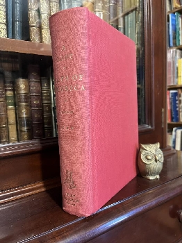
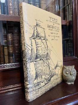
The First Folio of Shakespeare. The Norton Facsimile prepared by Charlton Hinman. Based on Folios in the Folger Shakespeare Library in Washington. With a new introduction by Peter W. M. Blaney.
Second Edition; Cr. Folio; pp. xl, 928; b/w portrait, original quarter morocco with printed linen boards, 5 raised bands, title lettered in gilt on spine, silk page marker, printed slip-case, fine copy.
New York/London, W. W. Norton & Company, 1996.
The Norton Facsimile set a new standard for scholarly accuracy. It was the first facsimile in which every page had been selected from a large number of copies in an attempt to find a clean, clear example with minimal show-through. Even more important, it offered the latest, most corrected state of pages known to vary from copy to copy because of correction at press. Finally, it introduced a standard system of reference, "through line numbering," based on the lines printed in the 1623 edition rather than on the acts, scenes, and lines of a modern edition. These improvements, the meticulous work of the great Folio scholar Charlton Hinman made possible by the extensive Folger Library Collection, established The Norton Facsimile as an indispensable volume for book collectors and serious readers of Shakespeare. Click here to Order
AUD$150

128521
THE TIMES.

The Times Comprehensive Atlas Of The World: Eleventh Edition.
Eleventh Edition; Med. Folio; pp. 68, v, 124 (double page maps), 224; endpaper maps, glossary index, lose card showing principal map abbreviations, bound in original grey cloth, title lettered in gilt on spine and front board, dustjacket, housed in its original illustrated slipcase, fine copy.
London; Times Books; 2005. Click here to Order
AUD$85

128405
TOOLEY, R. V.

Collectors' Guide to Maps of The African Continent and Southern Africa.
First Edition; Cr. 4to; pp. xvi, 32, (100) maps; coloured map frontispiece, illustrated title page, 5 full page coloured maps, numerous text illustrations, 100 pages of b/w. maps, index, bound in original brown cloth, title lettered in gilt on spine, dustjacket a little worn, very good copy.
London; Carta Press; 1969. Click here to Order
AUD$90

128388
TOOLEY, R. V.

The Mapping of America. With an Index compiled by Douglas Matthews.
Third Impression; Cr. 4to; pp. xii, 519; illustrated with 179 b/w. plates, index, bound in original blue cloth, title lettered in gilt on spine, dustjacket, previous owner's name on front endpaper, otherwise a very good copy.
(London); Holland Press; 1988. Click here to Order
AUD$60

128448
TOOLEY, R. V.

The Mapping of Australia and Antarctica.
Second Revised Edition; Cr. 4to; pp. xlii, 649; endpaper maps, illustrated with 256 b/w. maps, index, bound in original green cloth, title lettered in gilt on spine, previous owner's name on front endpaper, some minor marginal annotations in pencil in margins, good copy.
London; The Holland Press Limited; 1985. Click here to Order
AUD$325

128460
TYACKE, SARAH.

London Map-Sellers 1660-1720: A collection of Advertisements for Maps placed in the London Gazette 1668-1719 with Biographical notes on the Map-Sellers.
First Edition; Demy 8vo; pp. xxviii, 160; illustrated frontispiece, text with 17 b/w. illustrations, 1 large folding map at rear, references to works cited, index, bound in original green cloth, title lettered in gilt on spine and upper board, fine copy.
Tring, Hertfordshire; Map Collector Publications Limited; 1978. Click here to Order
AUD$45

128397
WALLIS, HELEN; General Editor.

Historians' Guide to Early British Maps: A Guide to the Location of pre-1900 Maps of the British Isles preserved in the United Kingdom and Ireland. (Royal Historical Society Guides and Handbooks No. 18).
First Edition; Demy 8vo; pp. x, 465; index to repositories, bound in original red cloth, title lettered in gilt on spine and upper board, previous owners bookplate on front endpaper, very good copy.
London; Royal Historical Society; 1994. Click here to Order
AUD$40

128399
WALLIS, HELEN M; ROBINSON, ARTHUR H.

Cartographical Innovations: An International Handbook of Mapping Terms to 1900.
First Edition; Cr. 4to; pp. xx, 353; illustrated frontispiece, text illustrated with 25 full page plates, list of terms, general index, index to bibliographies, bound in original green cloth, title lettered in gilt on spine and upper board, dustjacket with minor chips on edges, very good copy.
Map Collector Publications Ltd. in Association with the International Cartographic Association; 1987. Click here to Order
AUD$75

128393
WHEAT, J. C; BRUN, C. F.

Maps ad Charts Published in America Before 1800.
Second Revised Edition; Cr. 4to; pp. xxiv, 215; text illustrated with 16 pages of maps, one large folding map, references, index of names, bound in original green cloth, title lettered in gilt on spine, dustjacket with minor creases on edge, very good copy.
London; The Holland Press; 1985. Click here to Order
AUD$100

128459
WILLIAMS, JACK F.

China In Maps, 1890-1960: A Selective and Annotated Cartobibliography. (East Asia Series, Occasional Paper No. 4).
First Edition; Demy 4to; pp. [xvi], 365; text illustrated with 72 full page b/w. maps, 2 tables, bibliography, index, bound in original stiff illustrated wrappers, very good copy.
East Lansing, Michigan; Asian Studies Center Michigan State University; 1974. Click here to Order
AUD$175

128462
WITT, MARIO M.

A Bibliography of the Works Written and Published by David Steel and his Successors. with Notes on the Lives of David Steel and his Heirs. (Greenwich Maritime Monographs).
First Limited Edition; Med. 8vo; pp. xii, 156; family tree, 2 full page illustrations, 266 fully catalogued items, geographical index for maps & pilots, chronological index, bound in original blue cloth, title lettered in gilt on spine, dustjacket a little worn and marked, previous owner's bookplate on front endpaper, good copy.
Greenwich, London; Anthony & Setitia Simmonds; 1991.
Edition Limited to 525 copies of which numbers 1-500 are for sale. This copy is No. 61. Click here to Order
AUD$100

128469
WOODWARD, DAVID.

The Maps and Prints of Paola Forlani: A Descriptive Bibliography. (The Hermon Dunlap Smith Center for the History of Cartography, Occasional Publication No. 4)
First Edition; Demy 4to; pp. ix, (21 )plates, 60; text illustrated with 21 pages of b/w. maps, bibliography, references, index of persons, geographical index, bound in original stiff illustrated wrappers, very good copy.
Chicago; The Newberry Library; 1990. Click here to Order
AUD$50